söndag, augusti 30

Juli/Augusti 2020 - Del III - Abisko & Höga Kusten, Sverige

Driving to the north of Sweden from the (not completely) north of Norway was incredibly beautiful. Alongside the road we would see snowy mountains and lakes like mirrors. The idyll was however somewhat deconstructed as we stopped for lunch at we we thought to be the perfect spot, but where we (or at least I) were instantly attacked by mosquitoes and huge biting flies. Not much to do but put on mosquito-proof clothes, cover any exposed skin in repellent, and enjoy the nature. 


At one of the scenic photo spots along the way, we did our best to get a picture of the two of us together worthy to put on the wall, I don't think I need to tell you how many mosquito bites I got setting up the camera and posing for this photo...


In the afternoon, we arrived in Abisko by the entrance to the national park. Abisko is famous for being the place where the King's Trail (Kungsleden) begins, a 425 km long hiking trail, but you can also do shorter walks, or just enjoy the view of Scandinavia's largest alpine lake or the beautiful river Abiskojokk. We wanted to do some hiking here and after studying the map and talking to the staff of the national park, had a plan for a short 3-day route. We would walk the first 15km of the King's Trail, then take an unmarked but easy-to-follow path over the mountains, and then take another marked trail back.

We packed our camping stuff and enough food and snacks to last us three days and set off. The first part of the trail followed Abiskojokk and we really enjoyed the views. I was struggling a bit with back pain (probably hadn't adjusted my backpack correctly) but some breaks here and there on sunny rocks helped. A few hours later we arrived at the place we had planned to camp the first night. Like many other national parks in Sweden, you are only allowed to camp at certain areas, so we were expecting to have to share it with a bunch of other people.

What we had not expected, however, was that we would have to pay. Having passed one smaller tent area on the way which was free, and also not having really researched the King's Trail at all, we were a bit surprised to find the next tent area to have cabins, kitchens and staff - service for those who want it, unfortunately is was not possible to opt out. We decided to take a small detour and follow another small trail for about 2km in order to get outside of the border to the national park. As it was getting late and we were tired, we didn't walk to far after the border but put up our tent in the forest near a stream. Though again, we were surrounded by mosquitoes which rudely would even bite my face and scalp. In the end, we made a small campfire from damp wood and I stood in the smoke - despite knowing it would stick to my clothes and hair - in order to eat my dinner in peace.

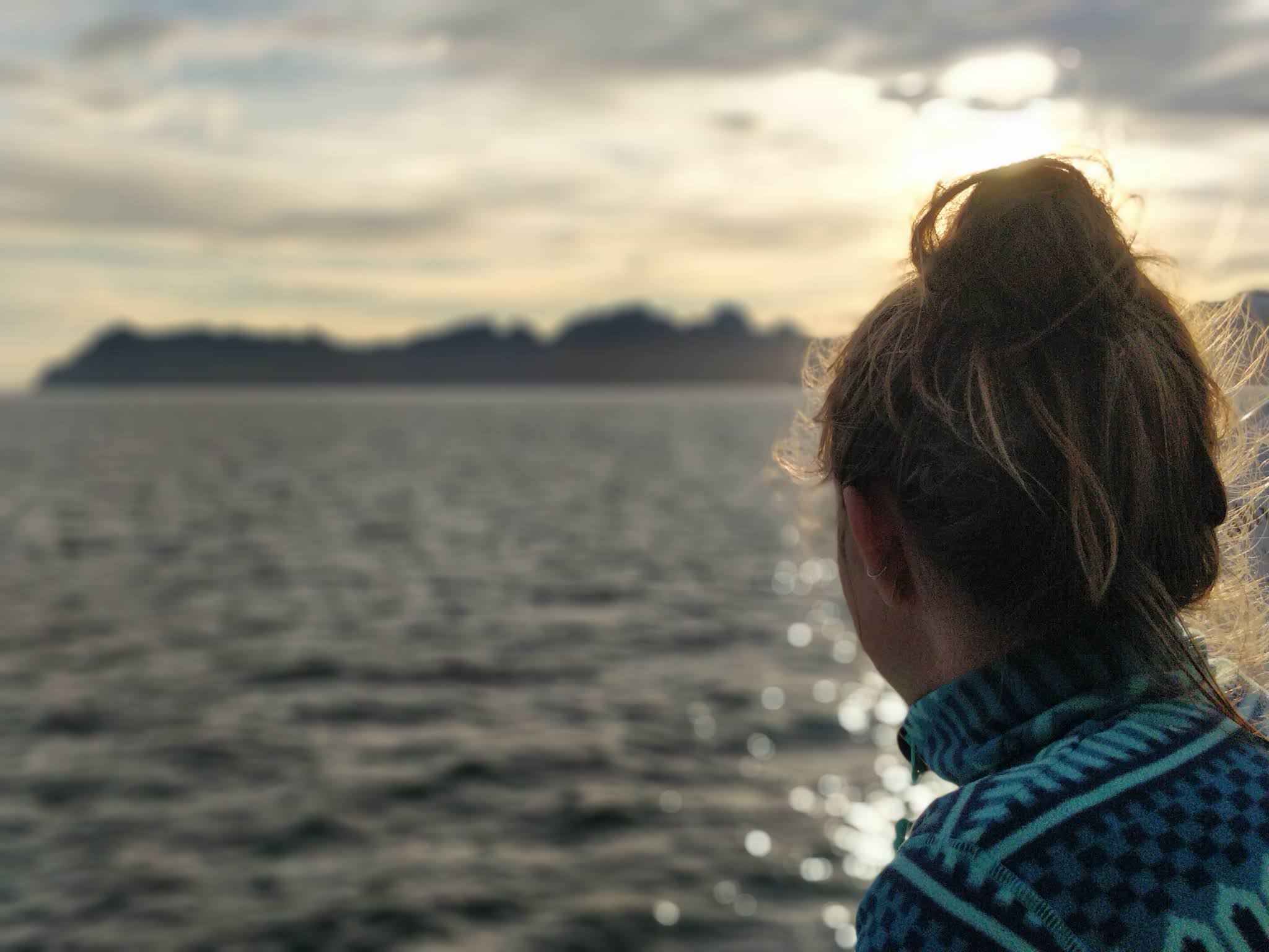
The next day we had to walk back to the tent area where we had deviated from our planned route, and then headed towards the mountains. The steepness varied a bit, but we had about 700 meters in altitude to climb, so we just took our time. Despite not being officially marked, small human-made towers of rocks every now and then made it easy to follow. Getting higher up meant less mosquitoes and flies (thoug we were never completely rid of them) and more cooling winds. We had to cross some patches of snow as well, and at times the path felt long and winding - but the more rewarding it was to get to the highest point and look down over the valley where we would set up camp for the night. 


At some point during that day we realised that we would later have to cross a river where there was no bridge. I was up for the adventure but also a little nervous, not having done anything like that before and not knowing really what to expect more than it being cold. And it was. Very cold. We took off our hiking boots and tied them to our backpacks. The river was several meters wide, and the water came straight from the mountains where the snow was melting. However, if the cold was the only problem it would have been fine - but we had not expected the rocks on the bottom of the river to be so slippery. So Valle went first, holding my hand to help me keep my balance, as we slowly made our way across, stepping up on top of dry rocks as often as we could to keep our feet from going numb. It was wobbly and slow, but eventually we made it across - definitely an adventure I will remember!

We did have to cross a number of smaller streams as well after that, but luckily they did not have any slippery rocks, and it was easy to do, and also actually kind of nice to go barefoot a while. It was still early in the afternoon when we set up our tent, and we enjoyed a few hours reading and napping in the sun before having dinner. The next day we were heading back towards our car. Another 15 km or so enabled us to have lunch by the Abiskojokk river only a few hundred meters from the parking lot.


It was time for us to starting heading south, having a long drive ahead of us, and we only made a few stops along the way. Just looking at the map, I never really understood just how long it would take to drive, but at least we didn't have to stress or pull any 12-hour drives. Our first stop was in Kiruna, which is not that far from Abisko. We took a short walk around the small town and sat down for a fika at one of the cafés for coffees and a cloudberry cheesecake (!). Driving in this part os Sweden we also saw quite a few reindeer on the roads.

Our tent spot for the night was in Muddos national park, a bit further south. Near a big, quiet lake, still plenty of mosquitoes but just as plenty of blueberries. The next day we started heading towards the coast, and the long drive was even slower due to roadwork on a long section of the road. Eventually we arrived in Luleå, where we took a stroll around the Old Town (Gammelstaden), a world heritage site where you can walk among old, traditional houses - a very cute and cool place to see! 


We kept driving a bit further south before we set up camp by the water, about halfway between Piteå and Skellefteå. Valle discovered that there were berries growing along the seaside - small, ruby-colored berries that looked kind of like raspberries. Some quick research on google taught us that it was Åkerbär - a cross between raspberries and wild strawberries, typically found in arctic and alpine regions. They were super tasty and I spent a good part of that evening looking for these little gems.

The majority of the next day we spent driving, with our aim set on the High Coast (Höga Kusten) and Skuleskogen national park. When we arrived in the afternoon, around 4pm, the entire parking area was full except for one spot that luckily we could take. Most people seemed to be heading back when we set out on our walk, so it was not too crowded. We walked up to the top of the hill, then down to Slåttdalsskrevan, an impressive crevasse that you can walk through - and the finsihed with a long walk in the forest. Eventually we decided to stay in the national park for the night and set up camp at one of the dedicated tent spots, and we enjoyed a quiet evening by the water.


That was the last longer stop we made on the way back. We spent the last night by a lake in the Norrköping area, but otherwise mostly focused on driving back home. After sixteen days out, it was definitely nice to get back to our bed & shower.


söndag, augusti 16

Juli/Augusti 2020 - Del II - Lofoten, Norge

 When going to Lofoten by ferry, especially during the high season, it is recommended to buy the ticket in advance. But since we didn't have an exact plan on when we would get there, we only looked for tickets two days before. 2/3 of the tickets for the ferry between Bodø and Moskenes (Lofoten) are sold in advance online, and the rest is available for "drop in" - cars that just arrive at the terminal. So when we looked online, all the tickets were of course sold out. We had a bit of a drive to get to the ferry terminal, and because we would pass Saltstraumen - one of the strongest maelstroms in the world - at its peak time, we decided to take our time and then head to the terminal and hope to catch the next ferry. 

First we made a stop to do a short hike in a beautiful forest, and after we continued the drive to Saltstraumen. From the parking we could walk to the top of a high bridge and watch the stream from above, rushing and whirling past. We spent only enough time there to enjoy the view and take some photos before driving all the way to the terminal in Bodø.

We were there just over an hour before the next ferry would leave, but there were enough cars and motor homes before us that we didn't make it. The next ferry was supposed to depart at 15.00, just 90 minutes later, but due to technical issues it it was cancelled, and we had to wait until 18.00. If we were to miss that one to, we would have to wait until 22.00. Normally, we would have had a pretty good shot at making the one at 18 since we had a good spot in the queue, but since all the people who had bought their tickets in advance for the cancelled ferry would now get a guaranteed spot at the next ferry, it wasn't sure they would be able to take any cars from the "drop in" queue.


There wasn't much to do but wait and hope, and we decided to do that while exploring the small town. We found some nice street art, coffee and ice cream, enough to keep us busy for a few hours, but eventually we walked back to our car to spend some time reading. Some of the cars ahead of us had decided to try their luck with a different ferry - it would depart at 17.00, but would make a few stops along the way and would take twice as long to get to Lofoten, but could on the other hand guarantee a spot. 

As we were waiting, the terminal staff came and told us they had managed to bring in an extra ferry which would depart at 17.30, and after waiting more than six hours we were finally on our way to Lofoten. Four hours later we arrived, and started looking for a tent spot. All places we looked at seemed to require parking fees - and only accepted cash or Vipps (the Norwegian equivalent of Swish) as payment. So with no way of paying, we had to find a spot along the road big enough for the car - this was a recurring problem/solution across Lofoten. Eventually we found a spot by a lake, though we later realized it might have been a bit too close to someone's house. No one kicked us out, though.

The next day we started by exploring the small village nearby, Å. It's famous for its traditional fishermen's cottages, "rorbuer" (some of which has been made into accomodation for rental) and for cinnamon buns baked according to a traditional recipe in a bakery that was first built in 1844. We decided to take a walk around the lake where we spent the night, but again really underestimated how long it would take us. We ended up on the wrong path for a while which was steep, muddy and difficult to follow, and it was very warm, but eventually we got down to the intended path and were able to follow the beautiful route the whole way, and enjoy the scenery. Once back, we of course rewarded ourselves with cinnamon buns.

As we kept driving north, we passed one of the main sights - Reinebringen - a mountain which you can hike to the top to get a beautiful view over Reine village and the archipelago. However, all parking spots, roads, and the entire village were packed with cars that it was impossble for us to stop there. And, seeing all the tourists heading towards that hike, we weren't sure that we even wanted to join them. So we kept driving. A bit further north was another famous spot, often recommended for wild camping - Kvalvika beach. We wanted to do a hike there and potentially set up camp, but again we were met by parking fees we couldn't pay and lack of parking spots. But Kvalvika beach is divided into two parts, Nordvika and Vestervika, separated by cliffs, and doing some research we found a hiking trail leading to Vestervika - the less popular part of the beach.

We ended up doing a three hour hike with all our overnight stuff, which was incredibly beautiful and serene. Once at the beach, there were already four other tents there (and a flock of sheep), but they were spread out across the big area, and wasn't at all like the twenty-something tents on the other part of the beach. We had a really nice evening, and I stayed up "late" to watch the sunset - we were roughly two weeks late to see the actual midnight sun, but a sunset at 23.15 is not too bad either. 

The next morning we packed our stuff and decided to walk across the cliffs to the other beach to get a different route back - it was very steep, quite crowded, and in the end we had to walk several kilometers along the road to get back to our car, so we much prefered the hike the day before. On the other hand, the popular Nordvika beach got most of the afternoon/evening sun and also had a trail going up the top of the nearby mountain where a lot of people surely got some amazing photos of the beaches from above.


The next day, we drove past another "Lofoten sight" - the two beautiful beaches Haukland and Uttakleiv, that you can also do a hike between. Having another sunny day, we were up for some beach time but concerned about running into crowds again - which we did. Already a kilometer before the actual beach parking of Haukland beach, there were cars parked along the road making it difficult to even drive, even worse to meet other cars, motor homes, or even to turn the car around. Which we quickly did. And drove past the masses of people that covered the (otherwise indeed pretty) beach. Instead we drove up to Eggum - a small village by the ocean that also had a long, pretty beach. The "parking lot" was an empty field probably used by the local kids to play soccer, but we only shared it with two or three other cars. The beach was almost empty, and we got to enjoy the beach and go for a swim (for fun, not even for "showering") in the cool, salty ocean at this quiet hideaway.


Feeling quite overwhelmed by the amount of tourists in these small areas, and stressed from driving on roads too narrow to handle the amount of traffic and large vehicles, we only spent one more day in Lofoten. We drove to the small city Svolvӕr, which is the "capital" of Lofoten. We stopped just outside of the city for a walk around a lake called Prestvattnet, with an amazing view over the mountain Tjeldbergtind, before heading into the city center to take a walk by the harbor, have a smoked salmon sandwich and a fika, before the clouds started rolling in. They were so low and heavy that all the surrounding mountains suddenly disappeared into the mist, and it almost seemed as if they didn't exist at all.

We found a spot that was actually marked on Google maps as a "tent spot" - even with free, available parking, and with only two other tents in the area. It was overlooking the fjord, and as we were eating our dinner that evening we saw an eagle fly by. As silly as it may sound, to me that felt like a sign that we were now done with Lofoten - a sort of closure, that made it feel like the right choice to get in the car the next day and head towards the Swedish border.


onsdag, augusti 12

Juli/Augusti 2020 - Del I - Helgelandskysten, Norge

 This trip was probably the least well-planned so far - or at least, the least planned. We hadn't really given much thought to where we wanted to go when we rented a car - we just knew we wanted to go north, do some hiking, be in the nature. First we thought to go somewhere around the mid-Sweden "mountains" (fjällen) and do one longer or a few shorter hikes. But then Norway opened their borders, and an idea we had entertained at some point before covid suddenly became available again - to pick up where we left off last time and head north of Trondheim up to Lofoten. So we did.

We weren't even 100% certain we would be allowed to cross the border, but with ID in hand and a proof of residency of southern Sweden did the trick, and late afternoon we set up our first camp spot by a lake somewhere not too far from Oslo.

The weather quickly turned unstable, and for the next few days it wasn't uncommon to have bright sunlight while also seeing dark, heavy rainclouds, though most of the time it was just raining. As we drove on Kustriksveien along Helgelandskysten, one of the National Scenic Coastal Routes of Norway, we felt a bit beaten down by the cold and unwelcoming weather, dreading that all sixteen days would look like that. But then we were out camping in Brønnøysund, and we were woken up by the sun shining on our tent - we felt incredibly grateful and happy.


So the day started with an early morning dip in the very cold ocean to wash off some travel dirt. Then we headed straight to Torghatten, one of the famous sights along this coastal route, also known as fv17. Torghatten is a 258 meter tall mountain with a very photogenic tunnel, formed during the ice age, going straight through it - though according to the legends, the hole was actually made by a troll named Hestmannen. Getting there early meant we managed to get a bunch of pictures there before the crowds arrived. Since the weather was so nice, we wanted to spend as much time as possible outside, so we decided to walk to the top as well. We would however regret doing that hike in walking shoes rather than hiking boots, as it turned out to be steep, sometimes slippery, and at times had to be climbed with the help from a chain. Nevertheless, we were rewarded with an incredibly beautiful 360 degree view of the surrounding ocean, islands, and mainland mountains.


Driving along Helgelandskysten, there are some parts where you need to take ferries across. This first sunny day we took two of those. Lacking planning, again, we thought the ferries would run pretty often (some of them do, not all of them), and when at the second port we decided to just "take the next one" in order to drink some coffee from a local roastery, we didn't anticipate that it would be more than 1,5 hours until the next ferry. Although, while we were "stuck" in the tiny village Forvik, walking around the harbor and eventually settling down to read, we saw one small weasel (?!) and also some dolphins. So I can't really say we regretted that decision too much. Oh, and of course, the coffee was also great.


Then we reached the area with the famous Syv Söstre (the seven sisters), 7 mountain peaks around 1000 meters high. It was already late afternoon, so climbing to the top was not an option. Instead we opted for a walk that would only be a couple of kilometers, but which included going up to the rim of the southernmost mountain. It turned out to be more of an adventure than expected, as the first part of the walk was very steep. Once on the rim, the wind was so strong that it was difficult to walk in, though it was also kind of nice, as it was still around 20 degrees and I was sweating a lot. The second part of the trail was very beautiful and we really enjoyed it, even though the whole walk took nearly 2,5 hours - one hour more than we expected.

As it was getting late, we drove to a beach on the same island. Several others had also picked it for a nice camp spot, but we managed to find a spot a little bit further away from everyone else. Wanting to make the most out of this sunny day, we didn't mind having a late dinner, especially since the sunset was not until around 23. We also had a real treat that day - during our lunch break by the ocean, we found mussels on the rocks and picked a bunch - we cooked these in salt water from the ocean and had them as a pre-dinner snack. They were very small, but it still felt incredible to me to be able to handpick mussels and then have them for dinner! All in all, we had a great day filled with sunshine and adventure, and we regained some hope. During the night it was very windy (like loud windy) sowe didn't sleep that well, but the sun was shining again the next morning. And actually, we had sunshine almost every morning after that.

The next day, we had another three ferries to take, one of which took as across the arctic circle. We also drove past Svartisen glacier, which is the lowest glacier in mainland Europe and the second largest glacier in Norway. Though the best part of that day might have been the tent spot we found on Litlsanden - a bit further north of the big beach Langsanden on Sandhornøya on which there must have been more than twenty tents. Instead we got a small beach to ourselves as well as a beautiful evening view from a little hill where we found endless amounts of the biggest blueberries we'd ever seen.

The next day we were headed for Lofoten, which I'll tell more about in next post. Though I will say that we started the day with another ocean "shower" on our little beach, took a walk in a beautiful forest, and visited Saltstraumen, one of the worlds strongest maelstroms, before testing our luck at the Lofoten ferry terminal. To be continued...