Visar inlägg med etikett bergsbestigning. Visa alla inlägg

fredag, april 8

Mars 2022 - Nicaragua - Isla de Ometepe, Popoyo

Our next stop in Nicaragua was Isla de Ometepe, and island with two volcanoes tied together with a chunk of land. We spent a whole week on this island, first exploring, hiking, and kayaking, and then a few days to just relax. The first three nights we spent in Moyogalpa, the town where we arrived with the ferry. Our hostel was a bit like a homestay as we had both breakfast and dinner in the family’s kitchen. One of the days we rented a scooter and drove around the island, which was longer than we expected, and with pretty bad roads in some parts, but with beautiful views.


Our first hike was the western volcano, Volcán Concepción, 1610 m high. The return trip took about 6,5 hours, and we walked about 16km. First we went through the forest, steep and sweaty in the heat, stopping occasionally when our guide showed us different plants and their usages. Once we got about halfway up, we took a bit longer break. As we got above the tree line we were greeted by strong winds which cooled us down quickly, though we took care to apply some extra sunscreen as the sun was still very strong. The last part of the hike we basically walked straight up the volcano on the steep, rocky and windy path. The crater was very impressive, and we enjoyed the incredible view from the top as well as a small lunch before we headed back down. In the trees on the way down we saw some howler monkeys, a capuchin monkey and plenty of blue jay magpies.


The last four days we spent at Finca Mystica, a place a bit further into the jungle on the south part of the island, with cozy bungalows and great food. The shuttle we took between our accommodations was kind enough to stop at Santa Cruz, where the weekly Saturday market offered various food and snacks, many of them vegetarian or vegan, so we could buy a bunch to bring with us. In the afternoon, we decided to join some other people at our hostel going kayaking in the wetlands. While the wetlands area was beautiful and we got to see lots of birds, turtles and a caiman, we had to paddle pretty far to and from this very small area, where we only spent about 10 minutes. However, we had good company and once we returned to the kayak place we enjoyed a few beers and the sunset before we headed back to Finca Mystica.


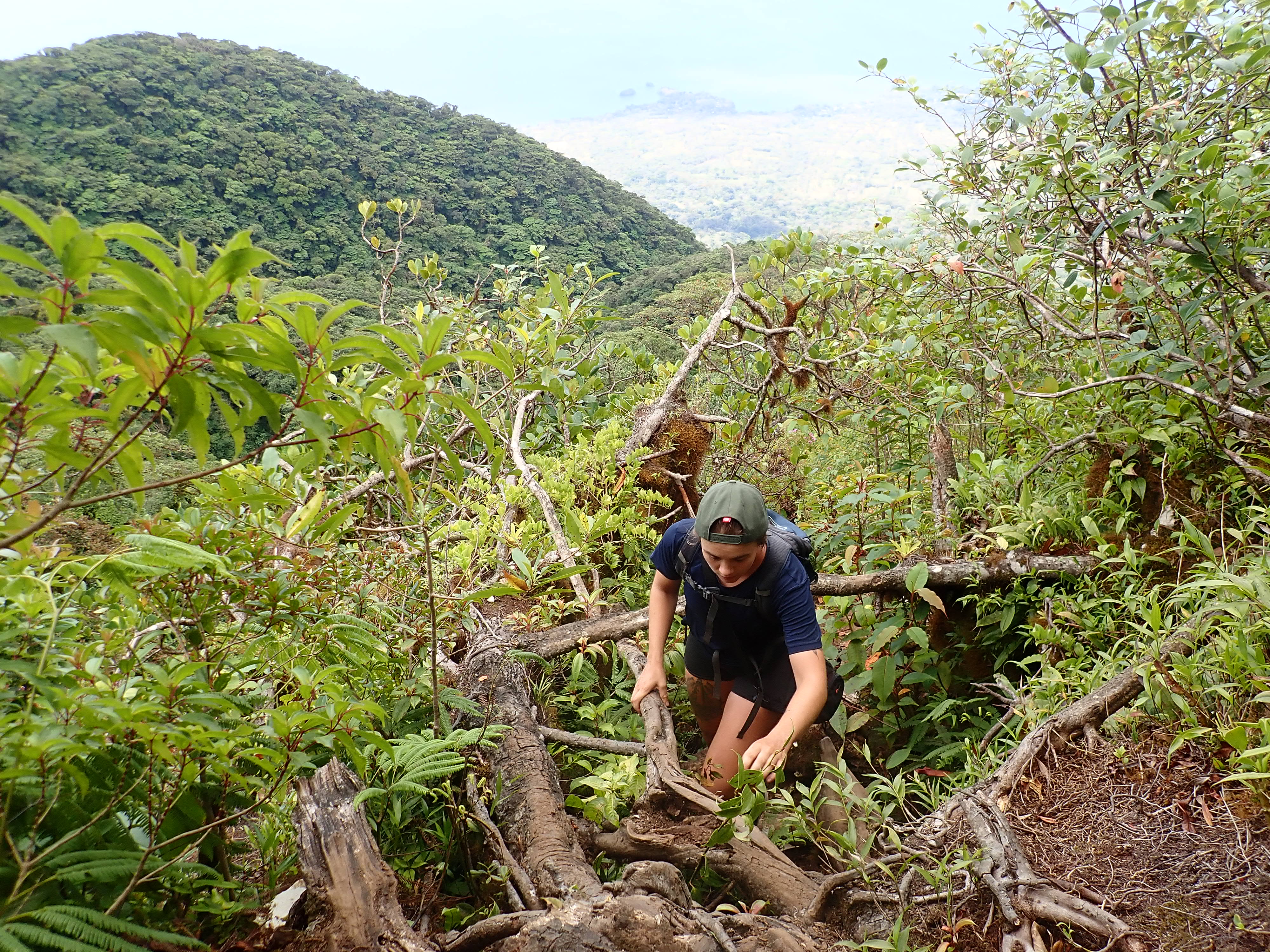
The next day, it was time to hike the second volcano, Volcán Maderas, 1394 m high. Maderas is a very old volcano which is now completely covered in forest, and with a crater lake. This hike was very different from hiking Concepción, and unlike any other volcano hike we have done before. When we got to about 1000 m elevation, the trail became very steep. Landslides had put big trees across the path, and we had to climb over, under and squeeze through branches and tree trunks, and often having to use both hands to climb our way up towards the summit. It was a lot of fun, definitely one of the more adventurous hikes we’ve done! As we had heard that it was possible to swim in the lake, we let our guide lead the way down into the crater. The trail down was very muddy and it didn’t take long before the both of us had stepped on what we thought was solid ground and ended up with a mud-covered shoe. And so, we were looking forward to a dip in the lake to wash off the mud before having some lunch. However, it turned out that the lake consisted of about 70% mud and just a small layer of water on top. Our attempts to swim ended up getting us more dirty than when we went in! If you ever find yourselves doing this hike – don’t try to swim in this lake. It’s not worth it. Overall we really enjoyed the hike though, and after hiking two volcanoes in just a few days we were happy to spend some more days just relaxing.

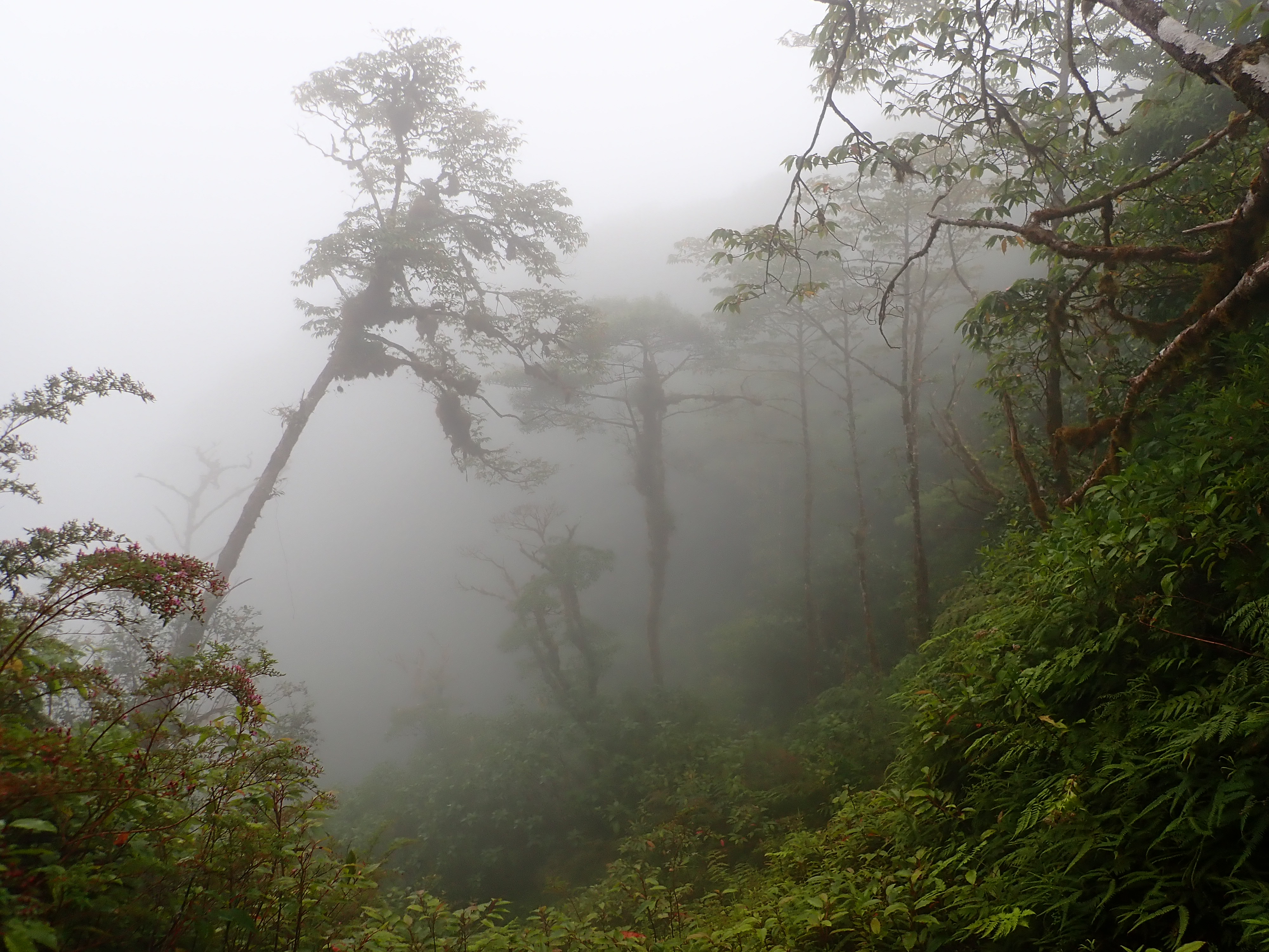
cloudy cloud forest

view of Concepción
the non-swimmable lake

Apparently we timed our stay with the last Sunday rodeo of the season, an event where all locals gather and there is plenty of food, drinks and music. This was however the same day that we hiked Maderas, and as we are not big fans of rodeo we decided to stay in, drink some local rum, and rest our tired feet. Others who went told us of a fun, chaotic evening with DJs as well as brass bands playing at the same time – no doubt an interesting experience.

Around this time, as we had been considering how and where to finish our trip and when to return home, the flight prices suddenly went up a lot, and we had to hastily buy a very expensive flight ticket back from Panama City. We also started to plan out a few stops in Costa Rica and Panama, and booked our accommodations during Easter as Semana Santa, as it’s called here, is a big holiday and we didn’t want to risk waiting and finding everything fully booked.

Time for our last stop in Nica, for which we chose Guasacate – the northern part of Playa Popoyo. Most hostels here were either expensive or fully booked, but we ended up finding a place via AirBnB – Casa La Aventura - that had a few rooms as well as our choice, a van remade into a “double room”. As with most of the Pacific Coast in this region, Popoyo is a surf spot, but we chose it as a place to relax, walk along the beach and read books. 


The hostess at our place told us about a turtle sanctuary a bit further north, where she had been lucky enough to see hundreds of turtles hatch, so we decided to rent bicycles for a day trip there. We stopped in El Astillero on the way, a small fishing village, where we had some nice lunch, including tostones con queso (fried plantain with big chunks of cheese). The last part of the road to the sanctuary was very steep, and we arrived tired, warm and sweaty only to find out that there were no turtles there, and that the beach still required and entrance fee to be paid. We managed to find another beach nearby where we rested a bit, before starting again on the long ride back. At least we got plenty of exercise, but I would say it’s not worth the trip (especially on rental bicycles) without knowing for certain it’s turtle season. A day walking along the beach and cooking some dinner was a nice way to finish off our time in Nica before heading to Costa Rica.


fredag, februari 25

Februari 2022 - Guatemala - Antigua, El Paredón

The first thing we noted (and liked) about Antigua was the many restaurants serving local food, something we felt were missing in both Flores and San Pedro La Laguna. Our hotel was located right across the street from the local market, which had an entire section just for small eateries. While somewhat overwhelming as they all were very persistent trying to get us to eat at their place rather than the next one (even though they all seemed to serve the same dishes), we saw several new things on the menus and the ones we tried were very good. One night we also found some street food in a small park - a tostada with a huge pile of beans, guacamole and veggies was definitely a treat!

The one activity though that most backpackers traveling through Antigua sign up for is to hike the volcano Acatenango. The volcano hasn’t erupted for many years and is considered safe to climb. With 3976m at the summit, it is nearly as tall as Mt. Kinabalu (4095m), the tallest mountain we have climbed (and the tallest peak in South East Asia). However, the main draw of the Acatenango hike isn’t the summit, but the nighttime view of the very active volcano next to it, Fuego.

Having read some about the hike and that it seems you get what you pay for, we decided to go for a “mid-range” tour operator – not the cheapest one, but not the most expensive either. The travel agency we booked with were very helpful, but unfortunately the information they gave us was wrong on a few points: when we asked about the group size, they first told us we would barely walk in a group at all – we would just get together around meals (which was not true, as during the hike we had to stop multiple times to wait for the people who walked the slowest); they also told us the bus would only be half full due to the pandemic, so maximum 10-12 people in the group (we were 22); and they told us we would only need to carry water and our warm clothes ourselves (yet on the bus we were given food packs which many people didn’t really have space for and had to carry by hand). Another odd thing was that when we stopped with the bus to pick up some warm clothes for people who wanted to borrow, a guy came on and told us it would be possible to do an extra hike to get closer to Fuego – but it was pretty expensive and we had to decide right then and there. We thought this felt a bit sketchy and declined. However, once it was time for that extra hike we were able to go along anyway, for the same price, and it was well worth it.


The first part of the hike took about 5 hours, mainly due to the many breaks we took along the way. At some point it was a bit annoying, as it could get pretty cold standing still, and it often felt like the breaks were way longer than needed. Along the way we had beautiful views of the surroundings. Once we reached our base camp at 3,600m we were assigned to tents – thankfully, the travel agency had at least given us the correct information that we would get a private tent. Then it was time for those who wanted to do the extra hike to Fuego, which was a strenuous 1,5h more, first downhill and then uphill to get to the rim of Fuego. Settling on the rim at a safe distance from the actual peak, we huddled up with our cameras ready and waited for the sun to set. Fuego has eruptions around once every 10 minutes, of varying sizes, but when it’s dark it looks incredible – like natural fireworks. It was freezing cold up there, and we waited for nearly two hours, watching the (mostly small) eruptions. Around 8pm it was time to head back to the base camp for dinner, but we only made it about ten steps before we heard the rumbling of a really big eruption and we turned around to see the lava being spit out and lighting up the whole top of the volcano – it was one of the most amazing things I’ve experienced.


After the 1,5h back to base camp we just had a quick dinner and then huddled up in our tent, trying to get some sleep as we had to make an early start for the summit. We didn’t sleep much though, and a few times during the night we would peek out of the tent to watch more big eruptions from Fuego. At 4.30am we started getting ready for the summit hike, which included putting on every single piece of warm clothing we had – the temperature at the summit is often around 0 degrees Celsius. We made it just in time for the sunrise, though we had to wait a bit extra for the sun to get past the clouds in the horizon. Still, it was a beautiful morning to spend on top of a volcano.


The hike back down went pretty fast, and back in Antigua we were happy to take a warm shower, get all the dust off and rest our tired feet. We had a few more days in Antigua which we spent walking around looking at pretty buildings, visiting museums (including a chocolate museum and a jade museum), taking a free salsa class, and trying craft beers at a local brewery. One of the days we took a cooking class, to experience more of the local cuisine and learn about the dishes and ingredients. The first dish we made was pépian, a flavorful stew with lots of spices that felt like something we would love to cook and eat around autumn in Sweden. We also made rice which was cooked with some spices and veggies, and a side dish which consisted of slices of a local variant of squash, with some local cheese (similar to feta) in between – and dipped in an egg based batter and deep fried. We also got to make tortillas, which was much more difficult than we could have imagined, and which left us even more impressed by the local women who do this all day every day and make it look like the easiest thing. For dessert, we cooked plantains (similar to bananas) and filled them with a mole of bean paste, local chocolate and sugar, and then deep fried them. It was a big, hearty, and tasty meal! It was so much food that we got to take some with us to have for dinner as well.


All in all we really enjoyed our stay in Antigua. We nearly made it our last stop in Guatemala, but we heard a few people at different occasions who warmly recommended El Paredón, so we thought, why not give it a visit? El Paredón is a small town by the coast, with black, hot, volcano sand and waves that vary in size throughout the day to cater surfers of various levels. It appeared to be a more relaxed and calm version of the famous surf spot El Tunco in El Salvador. It was definitely a nice place to just relax, read a book and be lazy. However, there are plenty of activities to engage in – our hostel offered not only surf boards for rent, but also beach volleyball opportunities and a slack line to practice your balance. We did rent a board for a day, but since it was seven (!) years since we last tried it, we were happy to be able to catch a bunch of the smaller waves. It felt like a great way to finish off our stay in Guatemala, except that I managed to get food poisoning (likely from aguachile, which was like a ceviche but in a different sauce). At least, a hammock by the beach is not the worst place to be sick and thankfully it only lasted for a day. I was enough recovered at least, to be able to spend a couple of hours on buses back to Antigua and onwards to El Salvador.


torsdag, september 6

Juli/Augusti 2018 - Trolltunga, Norge

Så var det dags för specialaren! Trolltunga får ett eget inlägg eftersom det var den mest organiserade (och mest spektakulära) delen av vår resa. De flesta har nog sett en eller ett par bilder från Trolltunga någon gång. Det är en plats där turismen fullkomligt exploderat de senaste åren, trots att det krävs lite av en kraftansträngning för att ta sig dit. Men bilderna från utkikspunkten är så fantastiska att det inte är så konstigt att så många människor lockas till att ta sig dit.

Vandringen upp till Trolltunga är tur och retur mellan 20 och 38 kilometer, beroende på vart man börjar. Men oavsett behöver man alltså orka gå minst 2 mil. Startpunkt(erna) ligger i närheten av Tyssedal, som är en liten ort vid Hardangerfjorden. Det är ca 4 timmars bilresa från Bergen. Det finns egentligen tre olika ställen man kan parkera på om man kommer med bil, och ju kortare man vill gå desto mer kostar det. Just i år hade de också höjt priserna rejält, lite tråkigt, men tycker ändå att det kan vara värt det.
Längst bort finns en parkering vid en idrottsplats, Tyssohallen, för ca 150NOK (osäker på detta pris). Men då får man alltså gå cirka 38km totalt, vilket är ganska mycket. När vi körde förbi verkade det inte heller som att man kunde tälta vid den parkeringen, åtminstone inte gratis.
Nästa parkering är den som är "vanligast". Det är vid en sjö i Skjeggedal, där finns totalt 250 parkeringsplatser och just i år hade de höjt priset till 500 NOK (för 24h). Därifrån är det totalt 28km att gå. Vi valde att parkera här, främst eftersom vi kunde gå en liten bit längre bort och tälta vid sjön.
Den närmsta parkeringen ligger en liten bit upp på berget längs en privat väg. Där uppe finns det bara 30 platser och kostar 600 NOK. Då behöver man "bara" gå cirka 20km.

De officiella turistsidorna brukar säga att man ska räkna med att det tar 10-12 timmar tur och retur. För oss tog det 7 timmar, men vi försökte också att hålla ett lite högre tempo. Jag kan verkligen rekommendera att börja tidigt på morgonen om man planerar att gå upp och ner samma dag. Främst för att det inte är så mycket folk längs stigen, och för att slippa köa så länge när man är framme. Vill man slippa köa helt och hållet är det nog bäst att ta med tält och mat och övernatta uppe på fjället, så att man får möjlighet att ta sina bilder i solnedgång eller soluppgång - eventuellt är det kanske också bästa chansen att få klart väder, men det ska jag nog inte spekulera så mycket om. Det är ju generellt ett ganska regnigt ställe, så man ska nog räkna med att det kan vara både kallt och blött.

Det är verkligen att rekommendera att ha bra skor, gärna några som tål regn och lera. Samt regnjacka och något mellanlager som är lite varmare. Mycket snacks eller mat så att man kan hålla energin uppe! Längs vägen finns flera vattenkällor, så man behöver inte ha så stor vattenflaska själv. Men vi såg flera personer (misstänkte att en del var från grupper som var på anordnad/guidad tur) som traskade i ljusa jeans, vita sneakers och tunna regnponchos. Det går såklart det också, men jag kan varmt rekommendera tränings/vandringsskor och en riktig skaljacka.


Vi satte väckarklockan på 05.00, och gick då upp för att laga frukost och packa ihop tältet, passa på att fylla på vatten och gå på toaletten (det finns alltså riktiga toaletter vid parkeringsplatsen, vilket det inte gör längs med vägen, så bra att passa på). Strax efter klockan 6 började vi gå. Den första sträckan från "mellanparkeringen" är längs med den privata vägen, det vill säga en brant asfaltsväg med hårnålskurvor som slingrar sig fram och tillbaka. Man kommer snabbt upp i puls på grund av lutningen, men terrängmässigt så kan man säga att det är ganska enkla fyra kilometer. Därefter kom vi upp på fjället, och det planade ut en del. Här var otroligt vackert, och väldigt fridfullt och stillsamt då vi var nästan ensamma på stigen. Vi njöt också av att ha klarblå himmel under första halvan av promenaden.
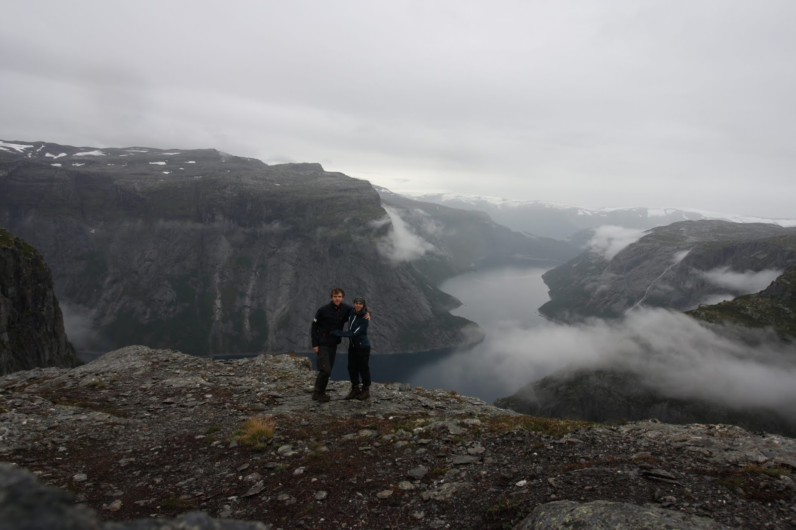
När vi hade gått lite mer än hälften av sträckan, cirka 7km, så blev det brantare, lerigare och regnigare. När vi gått 10km började det gå ganska långsamt. Den sista sträckan var väldigt seg, trots att det knappt lutade. Egentligen så kan man se Trolltunga på ganska långt håll, men från den vinkeln man kommer ifrån så ser man inte "avsatsen" som sticker ut, så det är svårt om man inte vet vad man ska titta efter. När vi äntligen var framme så var vi långt ifrån ensamma, men det var inte så farligt lång kö. När man ska ut på avsatsen får man klättra ner för några små "handtag" som de satt i väggen, och när vi kom dit var det bara så långt som kön sträckte sig - men trots det tog det mer än 20 minuter innan det blev vår tur.


Om man vill ha sina bilder tagna ur den "klassiska vinkeln" så behöver fotografen stå en liten bit längre upp - det är alltså svårt att få till bilder om man inte ber någon annan. De flesta är såklart hjälpsamma, men man kanske får instruera lite om man vill ha exempelvis variation i zoom eller exponering. De flesta personer gör ett par olika poser själv och sen tillsammans med eventuell vandringskamrat, så det kan ta en liten stund. Vi blev ganska kalla av att stå och vänta i regnet, men jag var otroligt glad att vi inte kom mycket senare - redan när vi skulle gå tillbaka, ungefär en halvtimme senare, var kön mer än dubbelt så lång.


Bara en liten bit längre bort från Trolltunga finns en stenformation som kallas Predikstolen, som inte heller är en så dum plats för att ta bilder. Men även här vill man gärna stå en liten bit bort för att få med de dramatiska vyerna. Eftersom det var folk som fotograferades här också gick vi ännu en liten bit längre bort och använde oss av självutlösaren på våra kameror för att få lite mer inzoomade bilder på oss.

Vägen ner trodde vi skulle gå mycket fortare, men på grund av regnet hade det blivit extremt lerigt, och när man började bli lite seg och trött så gick det inte heller så fort. Även om vi var lite besvikna över regnet så var vi väldigt glada och nöjda när vi kom ner igen. Det är en otroligt vacker vandring, och en fantastisk känsla att stå uppe på fjället, 1100 meter över havet och blicka ut över sjön och dalen. För oss var det också skönt att komma ner ganska tidigt på eftermiddagen, eftersom vi var tvungna att köra vidare och hitta en tältplats för natten.

Om man inte har bil, eller om man vill bo på camping, så går det bussar till och från både Odda och Tyssedal, men då får man en något senare start och får betala ca 250 NOK tur och retur.


Avslutningsvis: två bilder från vår sista dag på resan.