Visar inlägg med etikett kaffe. Visa alla inlägg

tisdag, mars 1

Februari 2022 - El Salvador - Santa Ana, Ruta de las Flores (Ataco)

We arrived in Santa Ana in the evening, and the bus which was headed to San Salvador had dropped us off at the side of the road by a gas station. With no internet available, a security guard at the gas station helped us call a taxi, though the guy droves us to the wrong hostel first as he didn't know ours. Thankfully that hostel owner (and Google maps) helped guide us to the right place - La Casa Vieja. The owner, Luis, was very kind and helpful, and immediately gave us information on activities in the area and how to get there, including the restaurant where we went for dinner. 

The national dish of El Salvador is pupusas, which is like tortilla dough stuffed with some vegetable or other ingredient and cheese, and then fried, and its often served with tomato sauce and pickled vegetables. The restaurant we were directed to was a popular place called La Ceiba, which offered as many as 22 different fillings (!) and the choice of corn or rice dough. Some of our favorites were: garlic, cilantro, and carrot.

Our first full day in the country, we decided to take it easy as I was still recovering from my food poisoning as well as the gastritis that hit me after, so we took a chicken bus to Lago de Coatepeque, which is an old crater lake. It is easiest accessed by going to one of the lakefront hostels; our hostel in Santa Ana had a deal with the Captain Morgan hostel by the lake, which meant we got a free "day pass" and could spend a ocuple of hours sunbathing, swimming in the lake, and reading in a hammock with a pretty view. The only downside was the lack of food options; there was basically nothing except for the hostel unless we wanted to walk several kilometers in the mid-day heat.

Lake view

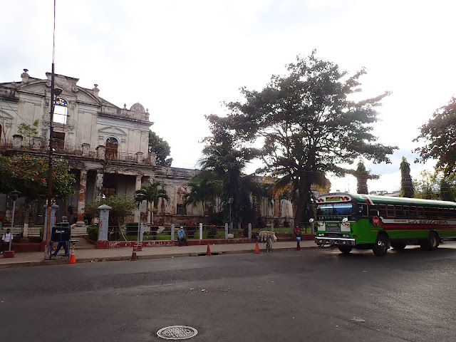
Santa Ana


Chicken bus

The next day we were up extra early to catch the chicken bus heading to the Santa Ana volcano, as there were only two buses per day going. After a long and slow ride, with the bus barely managing to climb the steep hill, we arrived at the parking lot with the other tourists. We were told that it was mandatory to go with a guide, so we all had to pay $3 per person, even though we barely saw the guide (who was at the very front) during the 1,5 hour walk to the summit. At the top we were rewarded with views of the surrounding landscape, as well as of the turqoise crater lake which smelled of sulfur. 


Our next stop in El Salvador was the small town Ataco, situated along the Ruta de las Flores. This route is, as the name suggests, supposedly famous for its many beautiful flowers. However, even though it was "in the right season", we didn't really see that many flowers. We concluded that either there is a better time of the year to see them, or the rumors are a bit exaggerated. Ataco is one of the smaller villages along the route, but it has a lot of charm with its streetart and varieties of food options. There are also the typical souvenir stands along the main roads, selling basically the same souvenirs as we have seen all throughout Central America so far.

Ataco is also the place from where you can explore the El Imposible National Park with "El Salvatours", the one tour company situated in the town. We were a bit hesitant as we found it a bit expensive, but last minute there was another couple who booked the same tour, meaning we got a better price but also some nice company. The tour started with a pretty long drive, with the four of us and our guide standing on the back of the pickup truck. The road into the national park was not very well used, steep and full of holes and we occasionally had to duck to avoid branches hitting us in the head. As we started walking into the jungle, our guide occasionally stopped to tell us about different plants and their medicinal traits. We hiked along a river and its waterfalls, and in several places got to choose between jumping into the water or taking a detour around. In one spot, where the waterfall was high, we put on a harness and were rappelled down with a rope. Eventually, we stopped near a fall where we got homemade tortillas and guacamole for lunch, and where we could rest, swim a bit and enjoy the sun, before starting the steep hike back to the car. Shortly before we reached the end of the "trail", we heard something moving around in the leaves - an armadillo! We even saw another one hurrying across the road as we were driving back. All in all, we had a great time during this hike; it was the perfect amount of adventure, at a place where probably not that many tourists go, and with a great tour guide and good company.


The next day, we decided to explore the other towns along the flower route, traveling with the very cheap local chicken buses. Our first stop was Apaneco, another small village. Apart from some street art, there wasn't too much to see. We did pass some time (and spend some money) walking around in a big maze, which initially confused us as we expected an entry and an exit, rather than having the same entry/exit point and a center. As the maze was placed on a slope, we got plenty of exercise walking up and down the hill before we realized there was a center, and finding our way there.

Our next stop was Juayua, which is perhaps the most popular village to stay in along the route - although we found that we liked Ataco much more. It is most famous for the weekly weekend "food festival", which we were of course excited to see. However, we felt that it was a bit overrated, as it was just two streets serving mostly the same type of dish - meat or fish, with rice and salad. We did manage to find another food stall which served some yuca based dough, filled with cheese and fried - very tasty! We also met up with our friends from the hike and got ourselves some piña coladas made from fresh pineapple and served in the pineapple as well. Very good, but not very strong ^^

Although we felt a bit disappointed in the food festival, we immediately got in a better mood when we returned to Ataco and saw the food market in our own village, which lasted way into the night. Here we tried riguas (also made from yuca), something they called tortas served with cheese and "cream", elote (grilled corn on the cob), chile rellenoi (stuffed peppers) and ponche (a sweet milk-based drink spiced with rum and cinnamon). It was exactly was we wanted from a food market, with lots of local treats to taste.


Yuca with cheese and "cream"

Our last day in El Salvador was spent in the capital, as we had to catch a very early bus the next day to Honduras. We didn't explore much; we stayed at a hotel near the bus terminal, and the area had mainly fast food and not much else to explore. In total we only spent a week in El Salvador, and could very well have spent another one there - doing the popular "7 waterfalls hike" from Juayua, or exploring the surf towns on the coast. However, we had to book our transportation and our acoomodation at the Dive Shop (!) in Honduras a few days in advance, so we had to guess at how many days we would want to stay. Still, we enjoyed our time in the country and felt that we got to explore several nice places and foods!


coffee!

onsdag, augusti 12

Juli/Augusti 2020 - Del I - Helgelandskysten, Norge

 This trip was probably the least well-planned so far - or at least, the least planned. We hadn't really given much thought to where we wanted to go when we rented a car - we just knew we wanted to go north, do some hiking, be in the nature. First we thought to go somewhere around the mid-Sweden "mountains" (fjällen) and do one longer or a few shorter hikes. But then Norway opened their borders, and an idea we had entertained at some point before covid suddenly became available again - to pick up where we left off last time and head north of Trondheim up to Lofoten. So we did.

We weren't even 100% certain we would be allowed to cross the border, but with ID in hand and a proof of residency of southern Sweden did the trick, and late afternoon we set up our first camp spot by a lake somewhere not too far from Oslo.

The weather quickly turned unstable, and for the next few days it wasn't uncommon to have bright sunlight while also seeing dark, heavy rainclouds, though most of the time it was just raining. As we drove on Kustriksveien along Helgelandskysten, one of the National Scenic Coastal Routes of Norway, we felt a bit beaten down by the cold and unwelcoming weather, dreading that all sixteen days would look like that. But then we were out camping in Brønnøysund, and we were woken up by the sun shining on our tent - we felt incredibly grateful and happy.


So the day started with an early morning dip in the very cold ocean to wash off some travel dirt. Then we headed straight to Torghatten, one of the famous sights along this coastal route, also known as fv17. Torghatten is a 258 meter tall mountain with a very photogenic tunnel, formed during the ice age, going straight through it - though according to the legends, the hole was actually made by a troll named Hestmannen. Getting there early meant we managed to get a bunch of pictures there before the crowds arrived. Since the weather was so nice, we wanted to spend as much time as possible outside, so we decided to walk to the top as well. We would however regret doing that hike in walking shoes rather than hiking boots, as it turned out to be steep, sometimes slippery, and at times had to be climbed with the help from a chain. Nevertheless, we were rewarded with an incredibly beautiful 360 degree view of the surrounding ocean, islands, and mainland mountains.


Driving along Helgelandskysten, there are some parts where you need to take ferries across. This first sunny day we took two of those. Lacking planning, again, we thought the ferries would run pretty often (some of them do, not all of them), and when at the second port we decided to just "take the next one" in order to drink some coffee from a local roastery, we didn't anticipate that it would be more than 1,5 hours until the next ferry. Although, while we were "stuck" in the tiny village Forvik, walking around the harbor and eventually settling down to read, we saw one small weasel (?!) and also some dolphins. So I can't really say we regretted that decision too much. Oh, and of course, the coffee was also great.


Then we reached the area with the famous Syv Söstre (the seven sisters), 7 mountain peaks around 1000 meters high. It was already late afternoon, so climbing to the top was not an option. Instead we opted for a walk that would only be a couple of kilometers, but which included going up to the rim of the southernmost mountain. It turned out to be more of an adventure than expected, as the first part of the walk was very steep. Once on the rim, the wind was so strong that it was difficult to walk in, though it was also kind of nice, as it was still around 20 degrees and I was sweating a lot. The second part of the trail was very beautiful and we really enjoyed it, even though the whole walk took nearly 2,5 hours - one hour more than we expected.

As it was getting late, we drove to a beach on the same island. Several others had also picked it for a nice camp spot, but we managed to find a spot a little bit further away from everyone else. Wanting to make the most out of this sunny day, we didn't mind having a late dinner, especially since the sunset was not until around 23. We also had a real treat that day - during our lunch break by the ocean, we found mussels on the rocks and picked a bunch - we cooked these in salt water from the ocean and had them as a pre-dinner snack. They were very small, but it still felt incredible to me to be able to handpick mussels and then have them for dinner! All in all, we had a great day filled with sunshine and adventure, and we regained some hope. During the night it was very windy (like loud windy) sowe didn't sleep that well, but the sun was shining again the next morning. And actually, we had sunshine almost every morning after that.

The next day, we had another three ferries to take, one of which took as across the arctic circle. We also drove past Svartisen glacier, which is the lowest glacier in mainland Europe and the second largest glacier in Norway. Though the best part of that day might have been the tent spot we found on Litlsanden - a bit further north of the big beach Langsanden on Sandhornøya on which there must have been more than twenty tents. Instead we got a small beach to ourselves as well as a beautiful evening view from a little hill where we found endless amounts of the biggest blueberries we'd ever seen.

The next day we were headed for Lofoten, which I'll tell more about in next post. Though I will say that we started the day with another ocean "shower" on our little beach, took a walk in a beautiful forest, and visited Saltstraumen, one of the worlds strongest maelstroms, before testing our luck at the Lofoten ferry terminal. To be continued...


fredag, januari 20

Roadtrip i Australien - Del 2

** Varning långt inlägg! **

En vecka efter att vi lämnat Melbourne var vi alltså framme i Sydney. Vi åkte tåg in till stan tidigt på dagen för att hinna med att utforska så mycket som möjligt. Vi började med att promenera ner till hamnområdet, som var ganska charmigt. Vi gick längs med vattnet ner till operahuset, som såklart var väldigt fint, och passade på att kika in på Museum of Contemporary Art (som dock inte var jättespännande). Det var väldigt varmt och fuktigt ute, så vi blev snabbt ganska trötta efter allt promenerande. Vi letade upp lunch i affärsdistriktet, ett hektiskt litet café som hette Sweetbeans, som hade väldigt goda mackor och fint kaffe. Därefter traskade vi ner till fontänen vid St Mary's Cathedral, kollade på konst i Art Gallery of NSW (stort och ganska trevligt), och sen den långa vägen ut till udden i utkanten av botaniska trädgården, som är det klassiska fotostället - där man kan få med både Harbour Bridge och operahuset i samma bild. Resten av dagen promenerade vi i botaniska trädgården och bland butikerna i centrum innan vi åkte tillbaka till vår camping.


Dagen därpå fortsatte vi vår resa, som nu skulle ta oss genom bergen ner till kusten en bit väster om Melbourne. Första stoppet var Blue Mountains, som fått sitt namn efter det blåskimrande diset som omger bergen när solen lyser på eukalyptusträden och oljan i bladen dunstar. Vi kom först till Wentworth Falls, där vi gick till utkikspunkten Princess Rock.Vattnfallet var imponerande ~300 m högt, men hade inte så mycket vatten. Efter lunch tog vi oss vidare för att kolla på stenformationen Three Sisters, Det hade varit ganska mulet hela dagen, och nu började det dessutom regna ganska kraftigt. Vi satt i bilen och läste medan vi väntade på att det skulle bli uppehåll, och sen skyndade vi bort för att ta några bilder innan nästa skur. Därefter körde vi direkt till campingplatsen för att gömma oss från regnet resten av dagen. Nästa dag hade det klarnat upp ordentligt, så vi började dagen med att köra tillbaka till Three Sisters och gå en liten promenad. Sedan körde vi vidare till Blackheath och Govetts Leap Lookout, där vi tog en långpromenad och kollade på fler vattenfall.

ruggigt väder!

Three Sisters

När vi lämnade Blue Mountains satte vi kurs mot nästa bergsområde - Snowy Mountains - där Australiens högsta berg ligger, Mt. Kosciuszko (ca 2 200 möh), och det blev mycket körning den dagen. Vi hade tänkt ta oss an Mt. Kosciuszko redan samma dag, men väl framme i Jindabyne hade det börjat blåsa väldigt kraftigt. Ägaren till restaurangen där vi åt lunch rådde oss att vänta, och lite senare började det dessutom regna, så beslutade oss för att vänta till nästa dag. Eftersom man måste betala per dygn i nationalparken ville vi vänta så länge som möjligt innan vi körde till kvällens campingplats, så vi parkerade oss på en rastplats och fördrev eftermiddagen med att läsa böcker. Väl på campingplatsen öste regnet ner till och från hela kvällen och hela natten. Nästa morgon regnade det fortfarande, men så fort vi kom upp ur dalen blev vädret mycket bättre. Vandringen till bergstoppen började i Charlotte Pass, som redan var 1 800 möh. Vägen till toppen var 9 km enkel väg, så vi hade några timmars vandring framför oss. Här var det såpass kyligt att det låg snö i drivor uppe på bergen; temperaturen låg kring nollstrecket. Det var en otroligt vacker omgivning och väldigt häftigt när man väl kom upp till toppen, men det var kallt och blåsigt, så vi var ganska glada när vi kom ner igen.


När man ser snö mitt i sommaren i Australien...
Uppe på toppen
Vi hade ganska långt att köra till nästa bergsområde, men vi stannade på vägen i Beechworth, en liten by med gamla, charmiga byggnader och gulliga caféer. Här åt vi lunch och tittade på fina smycken i ett guldmuseum. Vi hittade en camping uppe på en kulle, Mt.Alexander, där vi hade en otroligt vacker solnedgång. Morgonen därpå, när vi tog en promenad i skogen, såg vi kängurur skutta förbi. På eftermiddagen nådde vi Hall's Gap, en av orterna som är belägna intill Grampians National Park. Detta var andra gången på resan som vi tog in på betalcamping - dels för att det inte fanns så mycket annat i närområdet, och dels för att det är skönt att ha tillgång till varmdusch och kranvatten ibland. Vi passade på att utforska lite samma dag, så vi åkte upp i bergen på branta vägar. Vi stannade vid Boroka Lookout, Mackenzie Falls och Reed Lookout ("The Balconies"), som alla var väldigt fina. The Balconies var dock min favorit. Dagen därpå körde vi ner till södra änden av parken, där vi gick upp för Mt. Sturgeon, vilket var ca 3,5km enkel väg och en av de högsta topparna i Grampians. Det var otroligt varmt och vi fick flertalet insektsbett (från något som påminde om sandflugor), men blev belönade med en vacker utsikt. Därefter var det dags att bege sig ner till kusten igen, till Portland där vi åkte ut till Cape Nelson Lighthouse och lyckades få syn på ett myrpiggsvin!


Boroka Lookout 
The balconies
Mt Sturgeon 
Cape Nelson
Myrpiggsvin som gömmer sig i buskarna
Vår sista tisdag påbörjade vi kuststräckan tillbaka till Melbourne (västerifrån). I Port Fairy stannade vi till för att promenera runt Griffiths Island; inte en jättetrevlig promenadsträcka, men vi fick se några wallabies. Vidare körde vi till Tower Hill Reserve för ytterligare promenader bland emuer, och sedan till Warrnambool där vi fördrev lite tid på ett konstmuseum. På kvällen campade vi vid en å där det fanns näbbdjur, men trots att vi väntade tålmodigt i nästan två timmar fick vi inte syn på några. Dagen därpå kom vi till Great Ocean Road, precis som det låter en stor väg som slingrar sig längs med kusten, och där man kan stanna på ett flertal ställen för att kolla på coola stenformationer och branta klippor som stupar ner i havet. Ett av dessa ställen är Twelve Apostles, där klipporna har rasat och försvunnit ner i havet för att lämna sju "pelare" av sten kvar (namnet Twelve Apostles är enbart för att locka turister). Men det finns flera andra ställen som också är väldigt häftiga, och som, om man kommer tidigt på morgonen, inte alls är lika fulla av turister. Vi stannade bland annat och kollade på London Bridge, The Arch och The Grotto. Efter denna härliga kuststräcka körde vi ner till Cape Otway för att kolla på fyren; en lång, slingrig väg som leder fram till en liten butik/informationskiosk där vi får veta att hela området är inhägnat och man måste betala inträde för att få komma ner till fyren. Längs med kusten går dock en lång vandringsled, och vi går en liten promenad längs den tills vi kan se fyren från avstånd. Och bilturen ner var inte helt i onödan - längs med vägen finns massor med koalor som sitter i träden, och vi fick syn på en mamma med unge som satt och sov tillsammans på en liten gren. Till sist kör vi upp i nationalparken, ännu en lång och slingrig väg för att komma ner till Lake Elizabeth - ett sista försök att få se näbbdjur. Vi sitter där ganska länge, och vi ser något som plaskar långt borta, men annars är sjön spegelblank och stilla. När det börjar bli mörkt är vi tvungna att ge upp för att hinna köra till campingen.

Twelve Apostles
The Grotto


Koala med unge :)
Lake Elizabeth
 Vi är framme vid vår sista dag på resande fot, och vi har bara en kort kuststräcka kvar till Melbourne. Vi börjar morgonen med att promenera bort till ett vattenfall som ligger i närheten av campingen, och som är väldigt fint. När vi är ute på vägen igen kör vi till Anglesea, som har en väldigt turkos flod. Därefter åker vi till en chokladfabrik (där man får gratis provsmakning av chokladpellets) och åker och kollar på två stora surfstränder - Point Addis och Bells Beach. Nästa stopp var Torquay, där vi stannade ett tag för att ligga på stranden och läsa, och framåt kvällen körde vi till campingen som var en bensinmack i utkanten av staden.
Dagen därpå lämnade vi in bilen tidigt, och sedan hade vi helgen att spendera i Melbourne. Vi fördrev den mesta tiden med att gå runt bland de små gränderna, titta i affärer, gå på marknad och leta efter spännande mat. Vi drack gott kaffe och letade upp souvenirer, promenerade länge vid vattnet. Melbourne är en väldigt levande stad med mycket själ och kultur, och blev en av mina favoritstäder. Här finns street art, gallerior, små och stora affärer, små kaffeställen, billig mat och spännande mat, marknader, hav... det mesta man kan vilja ha. Och här är slutet på denna resan, och vi längtar såklart redan efter nästa äventyr!

Centre Place
Melbourne skyline